


Gilgit
Formerly known as the Northern Areas is the northernmost political entity within Pakistan. It borders Pakistan’s Khyber Pukhtunkhwaprovince to the west,Afghanistan‘s Wakhan Corridor to the north, China to the east and northeast, Azad Kashmir to the southwest, and Indian-administeredJammu and Kashmir to the southeast. Gilgit-Baltistan covers an area of 72,971 km² (28,174 miles²) and is highly mountainous. It has an estimated population approaching 1,000,000. Its administrative center is the city of Gilgit (population 216,760).
The territory became a single administrative unit in 1970 under the name Northern Areas and was formed by the amalgamation of theGilgit Agency, the Baltistan District of the LadakhWazarat, and the states of Hunza and Nagar. Pakistan and the majority of the local inhabitants of Gilgit-Baltistan consider the territory separate and distinct from Kashmir.
The name of Gilgit-Baltistan has recently been changed from “Northern Areas of Pakistan” to “Gilgit-Baltistan” after political reforms in the area, 2009.
Gilgit-Baltistan is administratively divided into two divisions which, in turn, are divided into seven districts, including the twoBaltistan districts of Skardu and Ghanche, and the five Gilgit districts of Gilgit, Ghizer, Diamer, Astore, and Hunza-Nagar. The main political centres are the towns of Gilgit and Skardu.
| Division | District | Area (km²) | Population (1998) | Headquarters |
| Baltistan | Ghanche | 9,400 | 88,366 | Khaplu |
| Skardu | 18,000 | 214,848 | Skardu | |
| Gilgit | Gilgit | 39,300 | 383,324 | Gilgit |
| Diamir | 10,936 | 131,925 | Chilas | |
| Ghizar | 9,635 | 120,218 | Gahkuch | |
| Astore | 8,657 | 71,666 | Gorikot | |
| Hunza-Nagar | Aliabad, Sikandarabad | |||
| Gilgit-Baltistan totals | 7 districts | 72,971 | 970,347 | Gilgit |
CLIMATE
The climate of Gilgit-Baltistan varies from region to region, surrounding mountain ranges creates sharp variations in weather. The eastern part has the moist zone of the western Himalayas, but going toward Karakoram and Hindu Kush the climate dries considerably.
There are towns like Gilgit and Chilas that are very hot during the day in summer, yet cold at night, and valleys like Astore, Khaplu, Yasin, Hunza, and Nagar where the temperatures are cold even in summer.
TOURIST ATTRACTIONS
ADVENTURE TOURISM
Gilgi-Baltistan is home to five of the
“eight-thousanders” and to more than fifty peaks above 7000 meters. Gilgit and Skardu are the two main hubs for expeditions to those mountains. The region is home to some of the world’s highest mountain ranges—the main ranges are the Karakoram and the western Himalayas. The Pamir mountains are to the north, and the Hindu Kush lies to the west. Amongst the highest mountains are K2 (Mount Godwin-Austen) and Nanga Parbat, the latter being one of the most feared mountains in the world, known as THE KILLER MOUNTAIN.
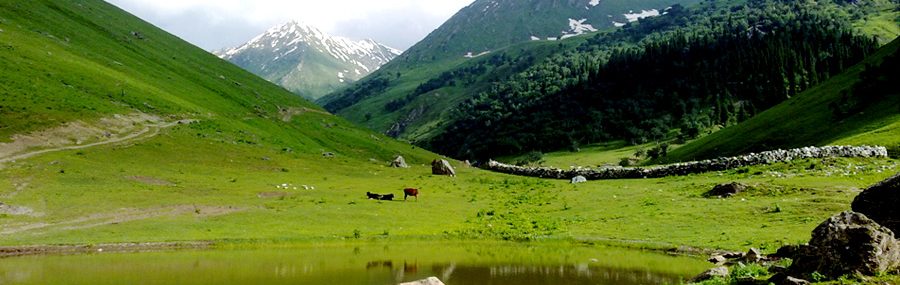
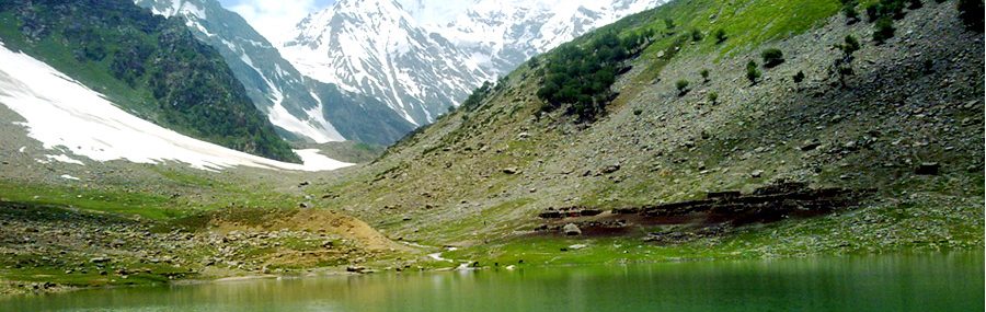
Three of the world’s longest glaciers outside the polar regions are found in Gilgit-Baltistan — the Biafo Glacier, the Baltoro Glacier, and the Batura Glacier. There are, in addition, several high-altitude lakes in Gilgit-Baltistan:
- Sheosar Lake in Deosai Plains – Astore region
- SatparaTso Lake in Skardu – Baltistan
- KatzuraTso Lake in Skardu – Baltistan
- ZharbaTso Lake in Shigar – Baltistan
- PhoroqTso Lake in Skardu – Baltistan
- Bara Tso Lake in Gangche – Baltistan
- ByarsaTso Lake in Gultari – Baltistan
- Borith Lake in Gojal upper Hunza – Gilgit
- Rama Lake near Astore
- Domale lake, minimarg Astore
- Rush Lake near Nagar – Gilgit
- Kromber Lake In Kromber Pass – Ishkoman Valley, Ghizer District
- khalti lake, district Ghizer
- Barodaroksh lake in Bar valley Nagar
DEOSAI PLAINS
The Deosai Plains, are located above the tree line, and constitute the second-highest plateau in the world at 4,115 meters (14,500 feet)after Tibet. The plateau lies east of Astore, south of Skardu and west of Ladakh. The area was declared as a national park in 1993. The Deosai Plains cover an area of almost 5,000 square kilometres. For over half the year (between September and May), Deosai is snow-bound and cut off from rest of Astore & Baltistan in winters. The village of Deosai lies close to Chilumchokki and is connected with the Kargil district of Ladakh through an all-weather road. Dosai plain is the home of brown bear which was before 1993 at the verge of extinction.
Rock art
There are more than 50,000 pieces of rock art (petroglyphs) and inscriptions all along the Karakoram Highway in Gilgit-Baltistan, concentrated at ten major sites between Hunza and Shatial. The carvings were left by various invaders, traders, and pilgrims who passed along the trade route, as well as by locals. The earliest date back to between 5000 and 1000 BCE, showing single animals, triangular men and hunting scenes in which the animals are larger than the hunters. These carvings were pecked into the rock with stone tools and are covered with a thick patina that proves their age.
Karakoram Range
(or Karakorum) is a large mountain range spanning the borders between Pakistan, India and China, located in the regions of Gilgit-Baltistan (Pakistan), Ladakh (India), and Xinjiang region, (China). It is one of the Greater Ranges of Asia, a part of the greater Himalaya while north of the actual Himalaya Range.
The Karakoram is home to the highest concentration of peaks over eight kilometres (five miles) in height to be found anywhere on earth,including K2, the second highest peak of the world (8,611 m/28,251 ft). K2 is just 237 m (778 ft) lower than the 8,848 m (29,029 ft) tall Mount Everest.
The range is about 500 km (311 mi) in length, and is the most heavily glaciated part of the world outside the polar regions. The Siachen Glacier at 70 km and the Biafo Glacier at 63 km rank as the world’s second and third longest glaciers outside the polar regions.
Transport
Prior to 1978, Gilgit-Baltistan was cut off from Pakistan and rest of the world due to the harsh terrain and the lack of accessible roads. All of the roads to the south opened towards the Pakistani-controlled state of Azad Jammu and Kashmir (AKJ) and to the southeast towards the present-day Indian-controlled state of Jammu and Kashmir. During the summer, people could walk across the mountain passes to travel to Rawalpindi. The fastest way to travel, however, was by air, but air travel was accessible only in good weather. Then, with the assistance of the Chinese government, Pakistan began construction of the Karakoram Highway (KKH), which was completed in 1978. The Karakoram Highway (KKH) connects Islamabad to Gilgit and China and from Gilgti to Skardu, which are the two major hubs for mountaineering expeditions in Gilgit-Baltistan. The journey fromRawalpindi/Islamabad to Gilgit takes approximately 20 to 24 hours. Landslides on the Karakoram Highway are very common. The KKH connects Gilgit to Tashkurgan and Kashgar in China via Sust and the Khunjerab Pass, the highest paved international border crossing in the world at 4,693 metres (15,397 feet).
Northern Areas Transport Corporation (NATCO) and many other private transport companies offer bus and jeep transport service to the two hubs and several other popular destinations, lakes, and glaciers in the area.
Pakistan International Airlines operates the brand-new ATR42-500 aircraft, daily between Gilgit Airport and Islamabad International Airport. The flying time is approximately 50 minutes, and the flight is one of the most scenic in the world, as its route passed over Nanga Parbat, the peak of which mountain is higher than the aircraft’s cruising altitude. With this new plane, cancellation of flights is much less frequent. PIA also offers regular flights of a Boeing 737 between Skardu and Islamabad. All flights, however, are subject to weather clearance, and, in winter, flights are often delayed by several days.
